The Lemosho Route
The Lemosho Route
Why Should You Climb
The Lemosho Route?
The Lemosho route is our most popular climbing itinerary and our preferred route on Mt. Kilimanjaro, due to its ideal balance of low traffic and a high summit success rate.
Why Should You Climb
The Lemosho Route?
The Lemosho route is our most popular climbing itinerary and our preferred route on Mount Kilimanjaro, due to its ideal balance of low traffic and a high summit success rate.
Lemosho Route Elevations
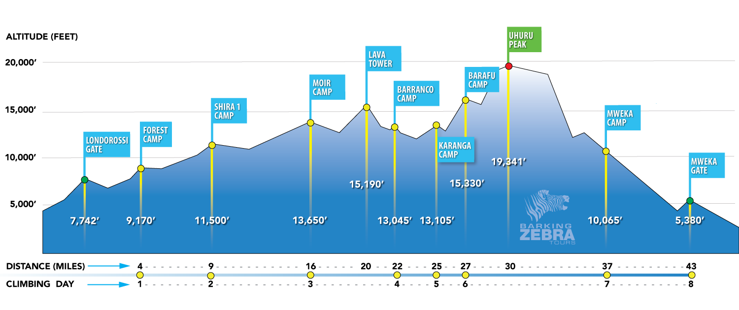
Lemosho 8-Day Itinerary
Elevation:
Londorossi Gate: 6,890 ft | 2,100 m
Forest Camp: 9,170 ft | 2,795 m
Hours of trekking: 3-4
Habitat: Rainforest
Meals: B/L/D
After breakfast, we depart to the western side of the Kilimanjaro National Park to Lemosho gate and complete registration formality. Our trek today will be an easy walk up a small path through beautiful and rain forest. Our first camp is located in the rain forest. Look out for black and white Colobus monkeys in the lush tree canopy.

Elevation: 11,500 ft | 3,505 m
Hours of trekking: 4-6
Habitat: Moorland
Meals: B/L/D
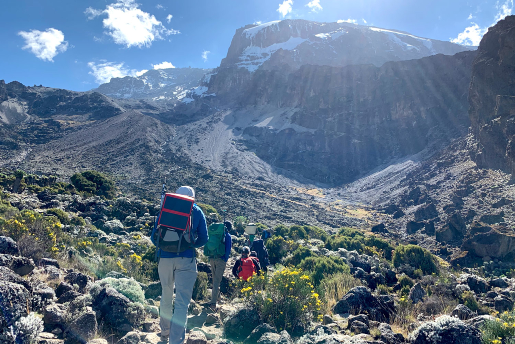
This morning we leave the glades and start trekking towards the moorland zone and Shira Caldera, which is a high altitude desert plateau. Shira Plateau shows the remains of an ancient caldera, a volcanic crater that expired around half a million years ago. Today, it stands as a World Heritage Site, boasting deep valleys and weather-beaten lava flows. We will get our first close views of Kibo – the summit of Kilimanjaro.

Elevation: 13,650 ft | 4,160 m
Hours of trekking: 5-7
Habitat: Moorland/Alpine Desert
Meals: B/L/D
Today we hike east across the Shira Plateau towards Moir camp, tucked away at the end of a massive gorge at the foot of a giant lava flow. Shira Plateau is one of the highest plateaus in the world.
Moir camp offers a fantastic view of Arrow Glacier and a welcome night’s sleep after a long trek.

Elevation: 13,045 ft | 3,976 m
Hours of trekking: 6-8
Habitat: Moorland/Alpine Desert
Meals: B/L/D
The trail becomes a bit rocky and strenuous as we get closer to the Lava Tower, a 300 ft tall volcanic tower. We have lunch at Lava Tower at 15,190 ft /4,630 m to help our bodies acclimatize to the thin air. This is where the Lemosho and Machame routes converge, so we meet other climbers ascending the Machame Route.
After lunch, we descend to Giant Senecio Valley to Barranco Camp. Although we end the day at a lower elevation than we started, this day is significant for acclimatization.
The view of the Western Breach from camp is spectacular.

Elevation: 13,105 ft | 3,994 m
Hours of trekking: 4-5
Habitat: Alpine Desert
Meals: B/L/D
Today our first challenge is to hike up the Barranco Wall, a 500 ft lava flow. It is a quite spectacular looking obstacle, which in the end usually turns out easier than how it appears. The views of crags and crevasses are stunning from the top of the wall.
We continue to walk up and down a greener valley to Karanga camp.

Elevation: 15,330 ft | 4,673 m
Hours of trekking: 3-4
Habitat: Alpine Desert
Meals: B/L/D
As we begin trekking today the trail turns steadily uphill. The temperature will grow colder and the landscape more sparse on the Machame route as we work our way to Barafu Camp. Barafu means “ice” in Swahili. The camp is set on an exposed ridge and is the staging point for our push to the summit.
The peaks of both Mawenzi and Kibo can be seen from the camp.

Elevation Uhuru Peak: 19,341 ft | 5,895 m
Hours of trekking to Uhuru Peak: 7-8
Habitat: Arctic
Elevation Mweka Camp: 10,065 ft | 3,067 m
Hours of trekking to Mweka Camp: 5-6
Habitat: Moorland
Meals: B/L/D
We’ll be up before midnight to set out for the glacier zone atop Kilimanjaro. Walk slowly, drink plenty of water and refuel with small snacks to keep our energy high until we reach the summit.
We celebrate our success with a few quick pictures at the top before trekking much of the way back down the mountain. Gaiters and trekking poles come in handy for the loose gravel going down.
Mweka Camp is situated in the upper forest and mist or rain can be expected in the late afternoon.

Elevation: 5,380 ft | 1,640 m
Hours of trekking: 3-4
Habitat: Rainforest
Meals: B/L
Celebrate your achievement with your mountain crew and partake in a tipping ceremony to thank your guides and porters, acknowledging their hard work and contribution to your success.
Descend back through the rainforest and enjoy a farewell lunch with your group at the Mweka gate.

Private Climbs
Let us build the Kilimanjaro climb that is perfect for you.
